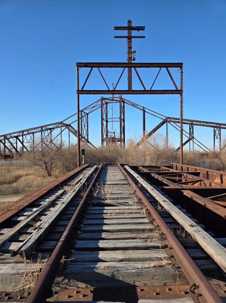
The historic East Omaha Bridge is among the most unique bridges in the country. Built in 1893 by the Omaha Bridge and Terminal Railway Company, it connected Omaha and Council Bluffs for rail service.

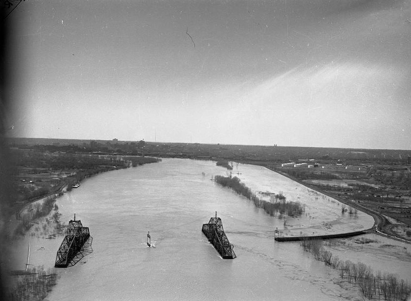
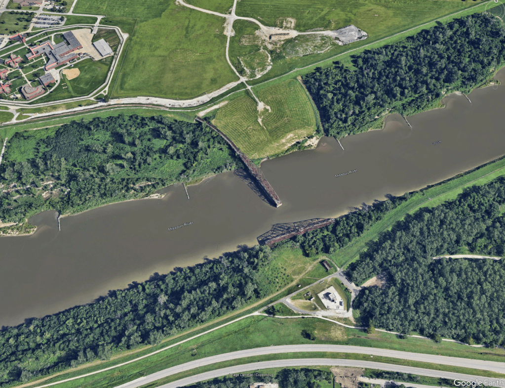
Constructed of wrought iron, it was originally a single swing bridge, with the Iowa side rotating open to allow barge traffic to pass while the Nebraska side remained fixed.

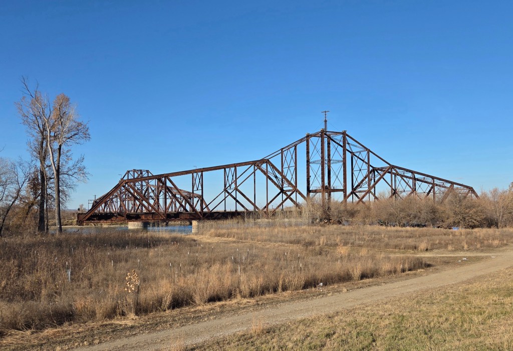
In 1904, a second swing span constructed of steel was added on the Nebraska side after the Missouri River’s navigation channel shifted approximately 300 feet from beneath the Iowa span to the Nebraska span. When completed, it became the largest swing bridge in the world, featuring two back-to-back swing spans measuring 520 feet each.
While reconstruction was underway, the Iowa Central Missouri Railroad had obtained rights to the bridge in 1899 and considered opening it to pedestrian and street traffic before ultimately deciding against the idea.

At 1,625 feet in length, it remained the longest swing bridge in the world until 1915. The bridge continued in service for decades, even as the construction of Gavins Point Dam, continued channelization of the river, and the building of levees left much of the Iowa swing span over land, rendering the double-swing design unnecessary.
The eastern span on the Iowa side was severely damaged by fire in the 1970s, leaving it unable to rotate. As a result, it was left in an open position to accommodate river traffic while the Nebraska span remained closed. When trains approached, a cable attached to a bulldozer was used to pull the span closed.

The Illinois Central Missouri River Bridge remained operational until 1980, when it was taken out of service. It was retained as a backup in the event of issues with the Union Pacific Missouri River Bridge.

After Canadian National Railway purchased the Illinois Central Railroad in 1998, the bridge remained unused and continued to deteriorate, even though the tracks stayed in place. It has been suggested that the bridge could be returned to service following extensive repairs.
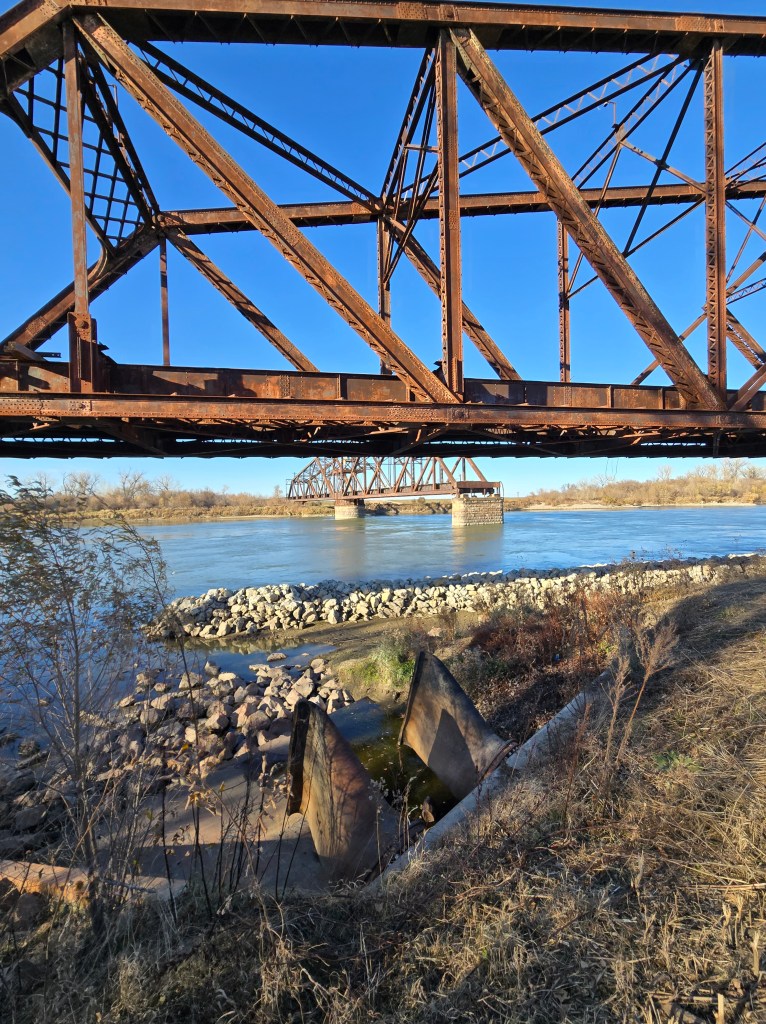
Considered an obstruction to navigation, the U.S. Coast Guard has in recent years called for its removal. For now, the distinctive bridge with its back-to-back swing spans remains a reminder of a time when East Omaha was its own village, long before it was consumed by the expansion of Eppley Airfield.

For those interested in seeing the bridge, it is three miles from Tom Hanafan River’s Edge Park along the Council Bluffs Levee Road a – flat trail that connects to the park. Located east of Freedom Park, it is more challenging to reach from the Omaha side due to the airport and correctional center.
Content written by Omaha Exploration. If you enjoy my content, you can follow or subscribe on my Facebook page, signup to receive emails or make a donation on my website. Thank you and until next time, keep exploring!
Read my content on Grow Omaha: Local History by Omaha Exploration | Grow Omaha
Omaha Exploration is sponsored by @Rockbrook Mortgage Inc.

Click the logo to learn more
Click here to learn about opportunities to sponsor Omaha Exploration!
More pictures
Follow OE on social media!
Get an email when new content is posted
Omaha Exploration, 2025. Unauthorized use and/or duplication of this material without express and written permission from this site’s author and/or owner is strictly prohibited. Excerpts and links can be used, if full and clear credit is given to Omaha Exploration with appropriate and specific direction to the original content.
Omaha Exploration proudly supports

Contact me or click the logo to learn more

Leave a comment