
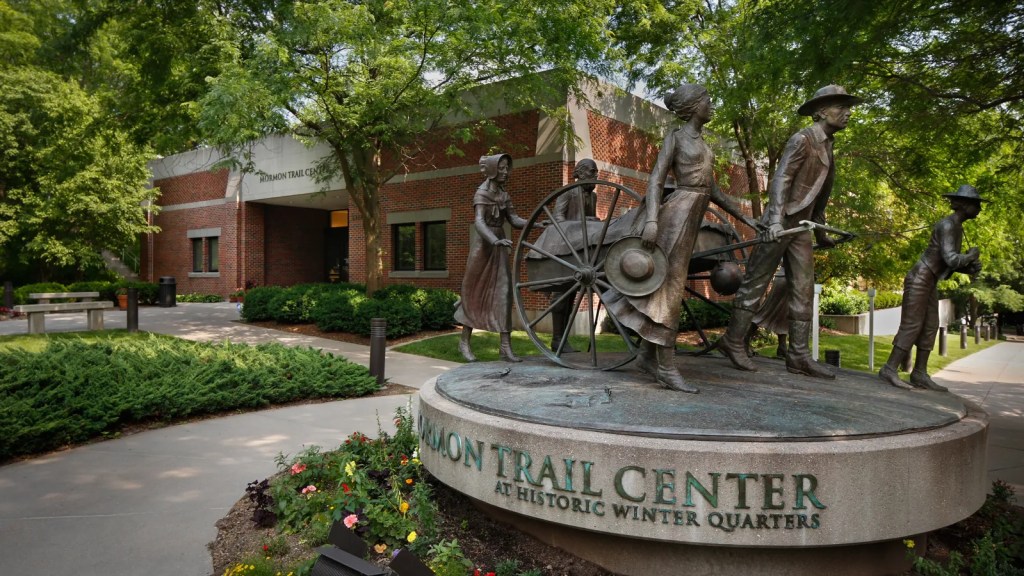
In the fall of 1846, nearly 2,500 Mormons crossed over onto the western banks of the Missouri River. They had faced religious persecution in both Illinois and Missouri, before they decided to head west beyond the borders of the United States for the Salt Lake Valley. While they had planned to wait until spring, local hostility forced their hand and they left in February. It took 131 days traveling in harsh conditions before they reached the relative safety of the Missouri River.
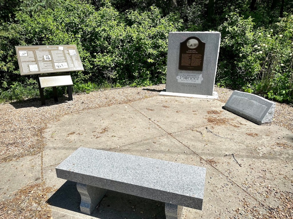
They proceeded to cross the river eight years before the area would become the Nebraska Territory. After receiving permission from the Indian agent acting on behalf of the United States government, they established Cutler’s Park in the valley covered with prairie grass and forests. The settlement was located near the intersection of Young Street and Mormon Bridge Road. On the site they built cabins, sod houses, created streets, a town square, park and school. It was likely the first town in Nebraska created by Europeans.
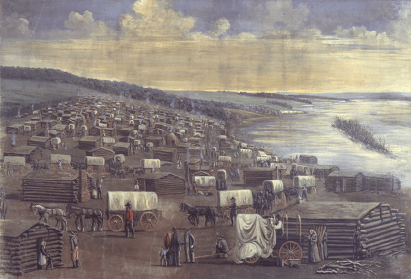
Just six weeks later they were forced to relocate as the settlement was located on the prime hunting site of the Omaha and Otoe Tribes. The misunderstanding caused them to move three miles east to the banks of the Missouri River. The Mormons proceeded to quickly build another new town site including 800 cabins which they called Winter Quarters.
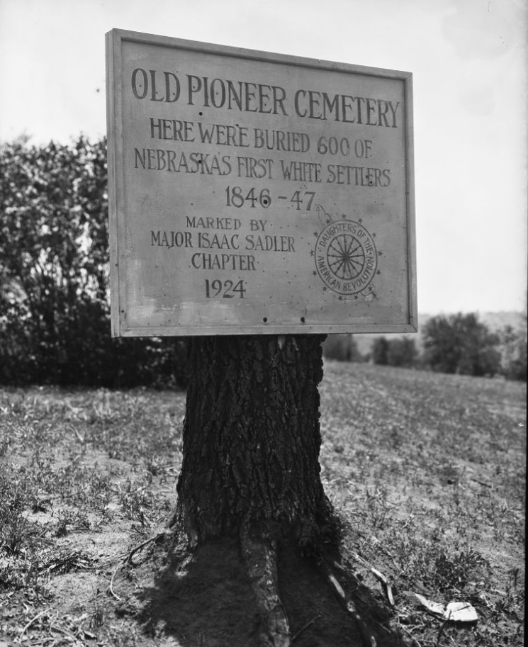
They weren’t prepared for the harsh conditions of the plains and over the winter many suffered from tuberculosis, starvation, scurvy, malaria and other diseases. In total 359 died and were buried at the Mormon Pioneer Cemetery. Today you can find the Mormon Pioneer Cemetery monument on Cooper Farm.
Once the weather broke, the first round of Mormons left in the spring to continue their trek west. Another group of Mormons stayed at Winter Quarters during the following winter. By the time they left in the spring of 1848, the temporary settlement was largely abandoned. They left behind the buildings, cabins and the mill they created.
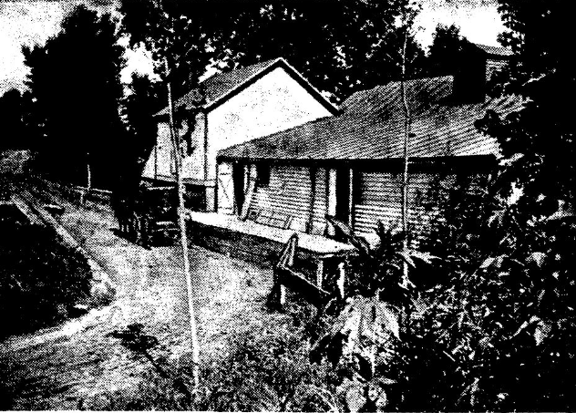
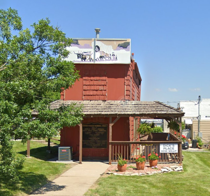
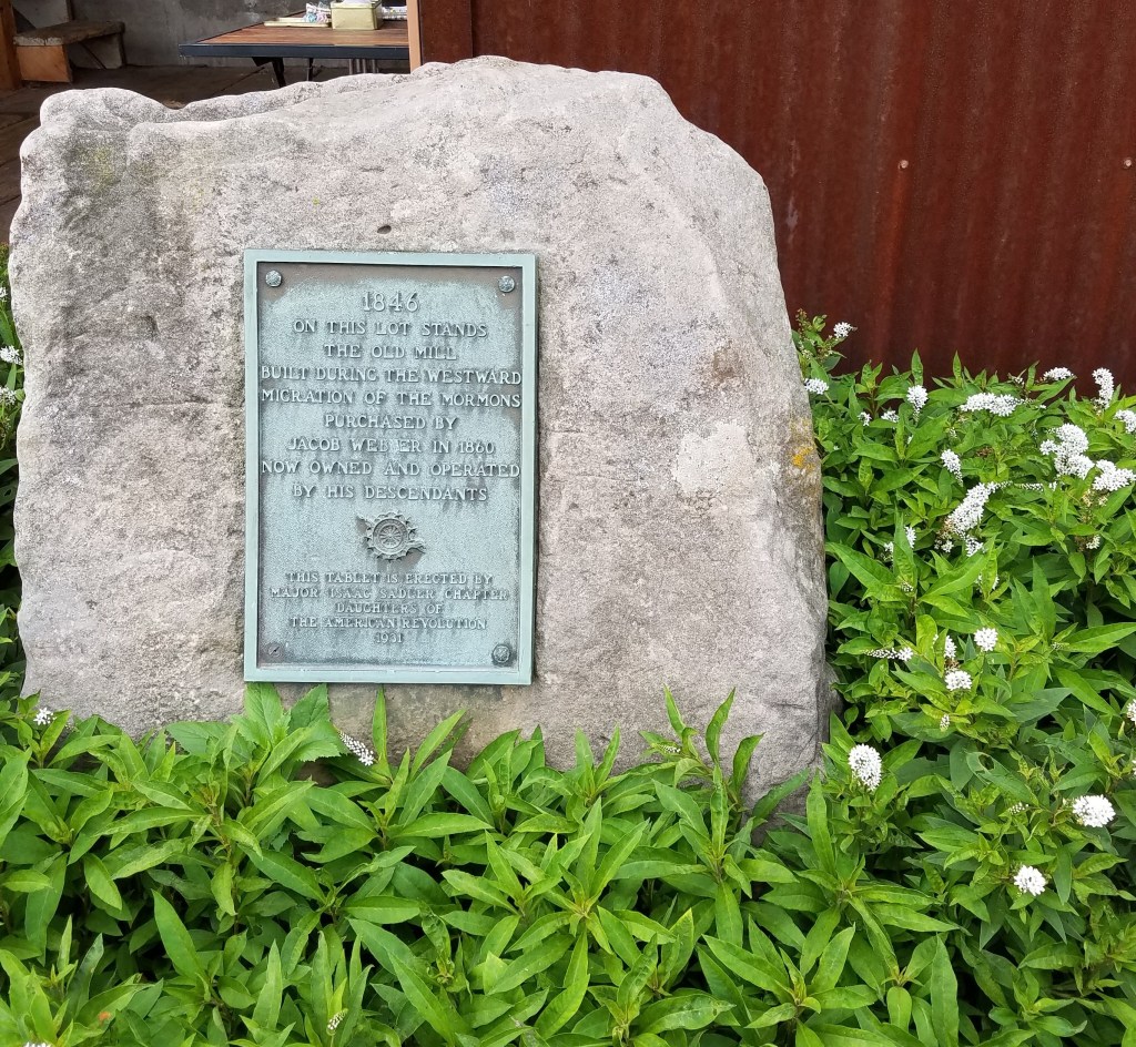
Located on Mill Creek, the grist mill was constructed in 1847 and used to grind corn and grain in order to make flour. Over years it was expanded, deconstructed, moved, reconstructed and modernized. Today it is commonly recognized as the only structure still standing from Winter Quarters.
Seven years later the Nebraska Territory was established in 1854. After learning about the abandoned Winter Quarters site, James C. Mitchell established a land company and platted the new town based largely on the original site. By his estimation, there was a lot of money to be made as the Transcontinental Railroad would be built from east to west across northern states. After making some improvements, a bank, train depot, fire house, jail, city hall and school were constructed. His city was the first in the new territory.
He named it Florence, after his wife’s daughter from her first marriage. Florence Kilborn passed away at just 14 years old. James had considered naming it Rock Bottom inspired by the fact that the river at this point had an actual rock bottom that would be the perfect place to build a train bridge for the railroad.
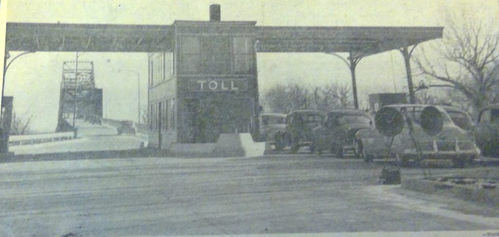
His goal was to establish a large city on the western banks of the Missouri where the bridge would be built. He didn’t count on some shady dealings with the competing town of Omaha City to the south. James goal was never realized as Omaha became both the site of the bridge and the territorial capitol due to its use of scrip to buy the votes of legislators.
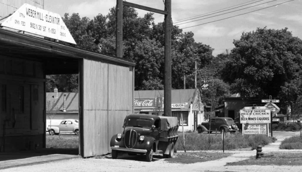
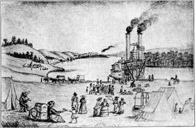
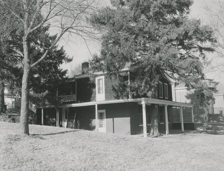
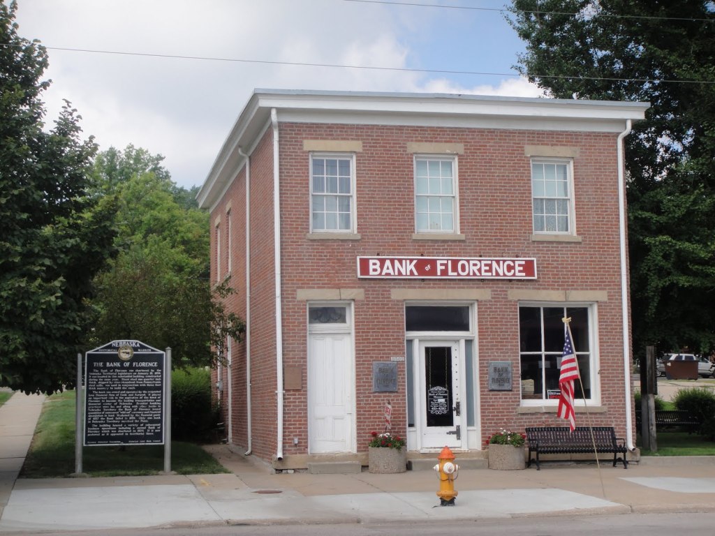
Those two decisions stifled Florence’s growth though the arrival of the streetcar helped double its population to 1,000. By 1907 the small town had the old mill, two general stores, two restaurants, two hotels, a livery and feed stable, real estate office, newspaper, four saloons, lawyers office, dentist and doctor’s offices, meat shop, coal yard, pool hall, bakery, gunsmith, drug store, blacksmith and a bank. The Bank of Florence operated as “wildcat” bank during the speculative days and printed its own money. It ceased operating as such around 1930.
Talk of annexing Florence and other surrounding towns including Benson, Dundee and South Omaha began to surface in 1909. While Dundee and South Omaha would be annexed six years later in 1915, Benson and Florence held out until 1917. Some of its street names would change including Main Street which became 30th Street.
After Nebraska instituted prohibition in 1917, Omaha crime boss Tom Dennison bought a house in the area. His house and many others had tunnels beneath them leading to persistent rumors of bootlegging and stills in the area. No proof that the tunnels were ever used for bootlegging has been discovered and it seemed unlikely that he would bootleg from his private residence. He was a private person that kept his business separate from his personal life. Dennison, after all, owned the mayor and the police department so there was no need for him to bootleg. Instead, he would just transport liquor in broad daylight.
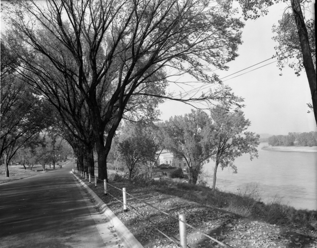
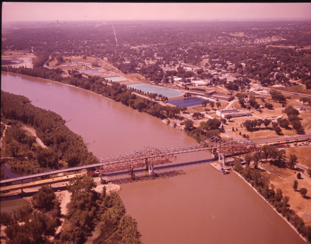
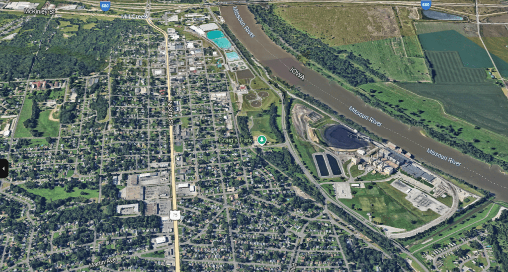
Omaha had grand plans to build the 19-mile long River Drive along the banks of the Missouri River starting in Florence and extending all the way to South Omaha. While the entirety of the drive was never built, the Florence section was completed. Today it is known as John J. Pershing Drive.
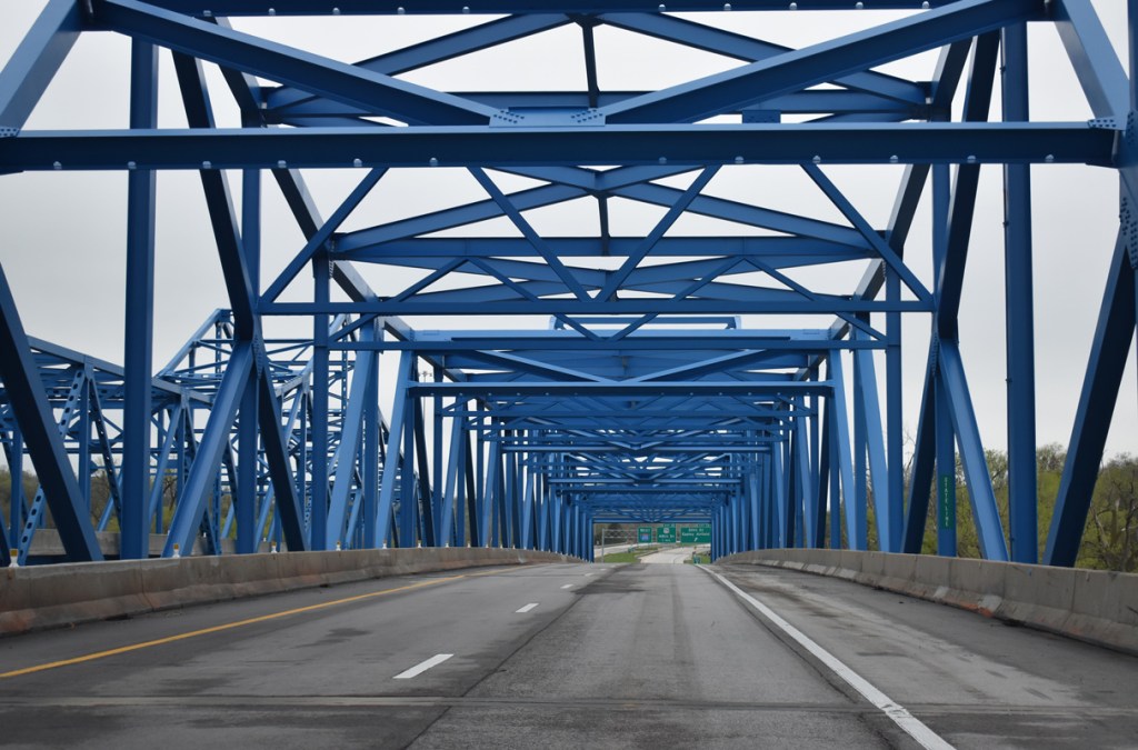
The construction of the interstate and the Mormon Bridge in the 1950s across the river caused the traffic along 30th Street to increase greatly causing it to be widened. The construction of I-680 orphaned the northernmost section of Florence where the Ponca Hills started to form. These actions had an adverse effect on the community which to this day struggles with retaining its neighborhood feel while attracting new business, protecting pedestrians and slowing or diverting traffic.
Proud of its heritage,Florence began a tradition with its annual parade in 1959 as a way to celebrate the community which has been successful in retaining a large number of its historic buildings including:
- Florence Mill (1847)
- Bank of Florence (1854)
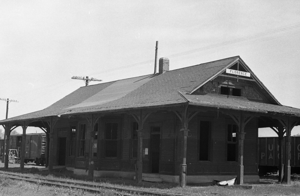
- Florence Depot (1887)
- Bank of Florence (1856)
- Florence Fire House (1888)
- Florence City Hall and Jail
Today Florence has a large number of monuments and buildings recognizing the area’s connection to the Mormon’s stay at Winter Quarters and the hardships that they experienced. Combined with those cultural sites, its tourist attractions and its historic business district which is still largely intact, the area is viewed as a potential up-and-coming district like those in Blackstone, Benson and Little Bohemia.
Content written by Omaha Exploration – follow my page for more! Please also feel free to leave a comment. If there’s something you want to learn more about, let me know. In the meantime, keep exploring!
Omaha Exploration is sponsored by @Rockbrook Mortgage Inc.

Click here to learn about opportunities to sponsor Omaha Exploration!
More pictures

Get email notifications when new OE content is posted
Follow OE on the socials
Omaha Exploration, 2024. Unauthorized use and/or duplication of this material without express and written permission from this site’s author and/or owner is strictly prohibited. Excerpts and links can be used, if full and clear credit is given to Omaha Exploration with appropriate and specific direction to the original content.

Leave a comment