Several months ago we explored the area that was once known as Sheelytown. If you missed it, check it out on my page. Today we explore Scriptown, an area that was originally referred to as North Omaha.

When Omaha City was incorporated in 1854 the first plat divided the area into 320 blocks. By 1855 the land north and west of the original plat was purchased by the Omaha Land Company. They were a private company owned by several prominent businessmen who helped found the city. They also included representatives from the Lone Tree Ferry Company which was critical in getting people across the Missouri River and into the city. Most people involved in the company were from Council Bluffs which predated Omaha.

The area got its name from scrip, the only currency available in the territory at the time, which was used to purchase the land. This is similar to how a company would pay its employees when regular money wasn’t available. It was essentially a bribe awarded to influential legislators who supported Omaha’s efforts to become the permanent territorial capital in exchange for valuable land that would become part of Omaha proper.

When Nebraska’s Territorial Governor Thomas Cuming declared that Omaha would be the site of first meeting for the new legislature, it proved controversial as other towns including Florence, Bellevue and Nebraska City felt they should become the territorial capitol. The bribe worked and Omaha was officially named the capitol on February 22, 1855. They remained as such until 1867 when it was moved to Lincoln.


Scriptown was first surveyed by Lorin Miller who would later become Omaha’s mayor from 1866-1867. His measurements placed the area of Scriptown from Cuming Street on the south, Fort Street on the north, 16th Street on the east and 24 Street on the west. Its northern border was adjoined by the town of Saratoga on the north. Due to land disputes the plat was left off of regular maps. These lots included Harbach’s, E. V. Smith’s, Denise’s, Paulson’s, Lake’s and Foster’s Additions.


The area was quickly divided into lots that were slightly smaller than the original lots and sold to developers with each of the supporters earning a tidy profit. The lots were quickly developed and soon the area outside of downtown Omaha contained a number of grand Victorian homes owned by prominent white residents like the bankers and politicians who received the scrip.


This area became Omaha’s first annexation in 1877. According to the Omaha World-Herald in 1878 many of the lots that sold for $15 each before the annexation were now selling at $150 each. By 1886 the Omaha Daily Bee reported that the lots were among the most desirable in the city with many selling as high as $3,000 to $3,500 each.

Over time as the city and its streetcar lines stretched further west to the suburbs, many of the residents moved away. African Americans filled many of the vacancies particularly when the city’s black population doubled between the 1910s and the 1920s due to the Great Migration. The Near North side today represents the heart of Omaha’s black community.

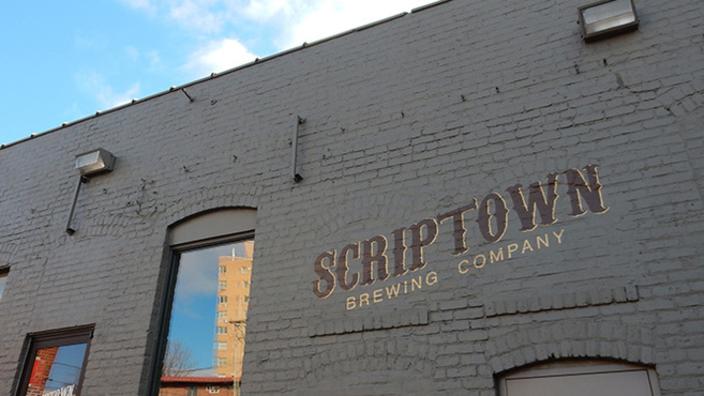
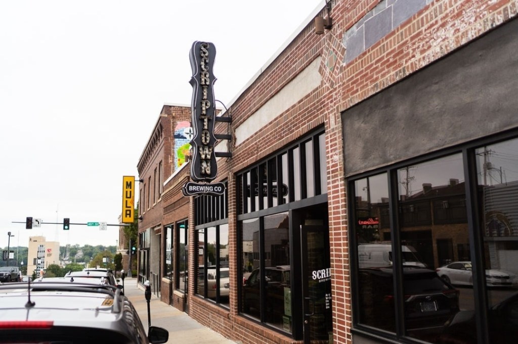
Today many of the historic buildings in the old Scriptown no longer stand while some are in disrepair. The only time most people come across the name scriptown is upon seeing Scriptown Brewing Company which opened in Historic Blackstone in 2012.
Please feel free to comment to share your thoughts.
Until next time, keep exploring!
More pictures


Thomas Cuming is on the left and Lorin Miller is on the right. Cuming was Nebraska’s Territorial Governor and Lorin Miller was the surveyor of Scriptown and would later become Omaha’s mayor.
Omaha Exploration is sponsored by

Click here to contact me if you’re interested in sponsoring OE.
Get email notifications when new OE content is posted
Follow OE on the socials
Omaha Exploration, 2024. Unauthorized use and/or duplication of this material without express and written permission from this site’s author and/or owner is strictly prohibited. Excerpts and links can be used, if full and clear credit is given to Omaha Exploration with appropriate and specific direction to the original content.

Leave a comment