Published September 24, 2024 | Updated July 11, 2026
Sitting on the western bank of the Missouri River near Ponca Hills was the first settlement in Nebraska. It was formed in 1846, eight years before the Nebraska Territory was opened for settlement.
Starting in the summer and continuing through the fall, nearly 2,500 Mormons crossed onto the western banks of the Missouri River. Facing religious persecution in both Illinois and Missouri, they decided to continue their trek west beyond the established borders of the United States to the Salt Lake Valley. While they originally planned to wait until spring, local hostility forced their hand and they left in February. It took 131 days traveling in harsh conditions before they reached the relative safety of the Missouri River.

They proceeded to cross the river eight years before the area would become the Nebraska Territory. They established camp in a valley covered with grass and trees. They received approval from the Indian agent representing the government. They named the settlement Cutler’s Park. It was located near the present-day intersection of Young Street and Mormon Bridge Road. On the site they built cabins, sod houses, streets, a town square, a park, and a school.

Just six weeks later they were forced to relocate the camp, which had been incorrectly located by the agent. As it turned out, the camp sat on a prime hunting site for both the Omaha and Otoe tribes. As a result, the camp moved three miles east to the banks of the Missouri River, where the Mormons quickly established Winter Quarters.

Winter Quarters looked more like a small town with a town square than a temporary settlement with a mayor, firemen, and police officers. In addition they built nearly 500 log cabins and 83 sod houses. During the winter of 1846-1847, it provided shelter for more than 3,000 people.

Despite that, the Mormons simply weren’t prepared for the harsh conditions of the plains. 359 perished due to tuberculosis, scurvy, starvation, malaria, and other diseases. They were buried at the Mormon Pioneer Cemetery. Today you can find the cemetery at 3301 State Street, along with a commemorative bronze statue titled Tragedy at Winter Quarters by Salt Lake City artist Avard Fairbanks, which depicts parents committing the body of an infant to the grave. It is adjacent to the Mormon Trail Center, a visitors’ center and museum.
Once the weather broke in the spring of 1847, the first group of Mormons left to continue their trek west. Church leaders, however, remained for another year as a second group stayed at Winter Quarters through a second winter on the plains before heading west. By April 1848 the camp was completely abandoned, leaving behind the buildings, cabins, and mill they had constructed over the course of their two-year stay.

Located on Mill Creek, the grist mill was constructed in 1847 and used to grind corn and grain to make flour. Over the years it was expanded, deconstructed, moved, reconstructed, and modernized. Today it is commonly recognized as the only structure still standing from Winter Quarters.
With the imminent opening of the Nebraska Territory for settlement, there was a rush to get there first and establish a large city — and thereby make a fortune in the process. While the Nebraska Territory wasn’t opened for settlement until May 30, 1854, land speculators often crossed the river ahead of time to scout the area. One of those men was James C. Mitchell. A fascinating character in his own right, Mitchell originally set out for California but decided to stay in Council Bluffs, where he opened a general store. He learned of the abandoned Mormon site from fur trader Peter Sarpy.

Mitchell crossed the Missouri River and platted the townsite in January 1854, largely following the previously established Winter Quarters site. He moved quickly, establishing a land company and staking a claim on what ended up being 277 lots. Among his other enterprises were the Winter Quarters Ferry, a steamboat ferry, and the Florence Bridge Company. He also worked as a saloon owner and editor of the Florence Courier newspaper.
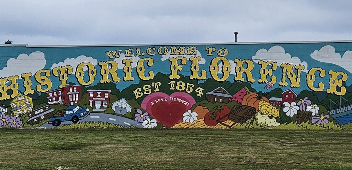
He set his sights even higher than just the establishment of a city along the river. His goal was to make it a large city that would become the site of both the transcontinental railroad and the territorial capital. After making some improvements, a bank, train depot, firehouse, jail, city hall, and school were constructed. Florence was founded more than seven years after Winter Quarters was vacated. The town was founded on October 3, 1854, four months after Omaha.

Mitchell named it Florence after his wife’s granddaughter. Florence Kilborn died at just 14 years old. Mitchell had considered naming it Rock Bottom, inspired by the fact that the river at this point had an actual rock bottom that would be an ideal place to build a train bridge for the railroad.
He ultimately lost his bid for Florence to become the site of the railroad and the capital, both of which were awarded to Omaha. Omaha resorted to some shady dealings, using scrip to buy the votes of legislators. The legislators used the scrip to enrich themselves in the area that became known as Scriptown.

Coming out on the losing end of both decisions stifled Florence’s growth until the arrival of the streetcar, which helped double its population to 1,000. By 1907 the small town had not just the old mill but two general stores, two restaurants, two hotels, a livery and feed stable, a real estate office, a newspaper, saloons, a pool hall, a bakery, and a meat market. It also had offices staffed by lawyers, dentists, and doctors, as well as a coal yard, a gunsmith, a drug store, a blacksmith, and a bank. The Bank of Florence had operated as a “wildcat” bank during the speculative days of the territory and printed its own money.

As Omaha continued to grow, talk of annexing Florence and other surrounding towns began to surface in 1909. This was decades after Omaha’s first official annexation of Scriptown in 1877. After operating independently for 63 years, Florence was annexed in 1917. As a result, some of its street names changed, including Main Street, which became 30th Street.
Starting in 1919, Omaha’s notorious crime boss Tom Dennison bought a house in the area at 6141 Florence Boulevard. The house still stands. It and many others had tunnels beneath them, leading to persistent rumors of bootlegging and stills. No proof that the tunnels were ever used for those purposes has been discovered, and it seemed unlikely that he would do so from his private residence. He was a private person who kept that aspect of his life separate from his family life. Quite frankly, he didn’t need to bootleg via tunnels since he effectively controlled the mayor and the police department, allowing him to transport liquor in broad daylight.

Following annexation, Omaha had grand plans to build the 19-mile River Drive along the banks of the Missouri River starting in Florence and extending all the way to South Omaha, which had already been annexed by this time. While the entirety of the drive was never built, a section running parallel to Florence was completed and is known as John J. Pershing Drive today.

The construction of the interstate and the Mormon Bridge in the 1950s across the Missouri River caused traffic along 30th Street to increase greatly, resulting in the street being widened. Meanwhile, the construction of Interstate 680 orphaned the northernmost section of Florence where the Ponca Hills begin, including the residential neighborhood of Wyman Heights. The infrastructure needed to support a larger city had a detrimental effect on Florence, which continues to struggle to retain its small-town feel. This is most evident along North 30th Street, where its historic business district is located. The fast-moving traffic deters some businesses and poses a risk to nearby pedestrians.

Florence has taken steps to protect its heritage and honor its past while celebrating the community that exists today. This started with an annual parade in 1959 and has since retained a large number of its historic buildings, including the Florence Mill at 9102 N. 30th Street, the Bank of Florence at 8502 N. 30th Street, the Florence Depot at 9000 N. 30th Street, the Florence Fire House at 8415 N. 29th Street, and the Florence City Hall and Jail at 2864 State Street.

With its roots in the Mormon settlement, Florence has a history unique from any other area within the Omaha metro. Winter Quarters and the extant historic structures situated in and near its business district make the former city of Florence a museum of sorts. It serves as a tourist attraction for those interested in local history while also standing on the precipice of becoming an entertainment district similar to those in Benson, Blackstone, and Little Bohemia.
Content written by Omaha Exploration – follow my page for more! Please also feel free to leave a comment. If there’s something you want to learn more about, let me know. In the meantime, keep exploring!
Omaha Exploration is sponsored by @Rockbrook Mortgage Inc.

Click here to learn about opportunities to sponsor Omaha Exploration!
More pictures


Get email notifications when new OE content is posted
Follow OE on the socials
Omaha Exploration, 2024. Unauthorized use and/or duplication of this material without express and written permission from this site’s author and/or owner is strictly prohibited. Excerpts and links can be used, if full and clear credit is given to Omaha Exploration with appropriate and specific direction to the original content.
Sources
- Omaha World-Herald archives
- https://preservation.cityofomaha.org/wp-content/uploads/2024/01/HD-030-N_Florence-Commercial-HD.pdf
- https://www.historicflorence.org/historicInfo.php
- A History of the Florence Neighborhood – NorthOmahaHistory.com
- Florence, Nebraska – Nebraska State Historical Society
- https://en.wikipedia.org/wiki/Winter_Quarters_(North_Omaha,_Nebraska)#:~:text=Winter%20Quarters%20was%20an%20encampment,miles%20west%20at%20Cutler’s%20Park.
- Mormon Pioneer Cemetery – Wikipedia
- Pioneer-Mormon Cemetery (U.S. National Park Service)
Leave a Reply