
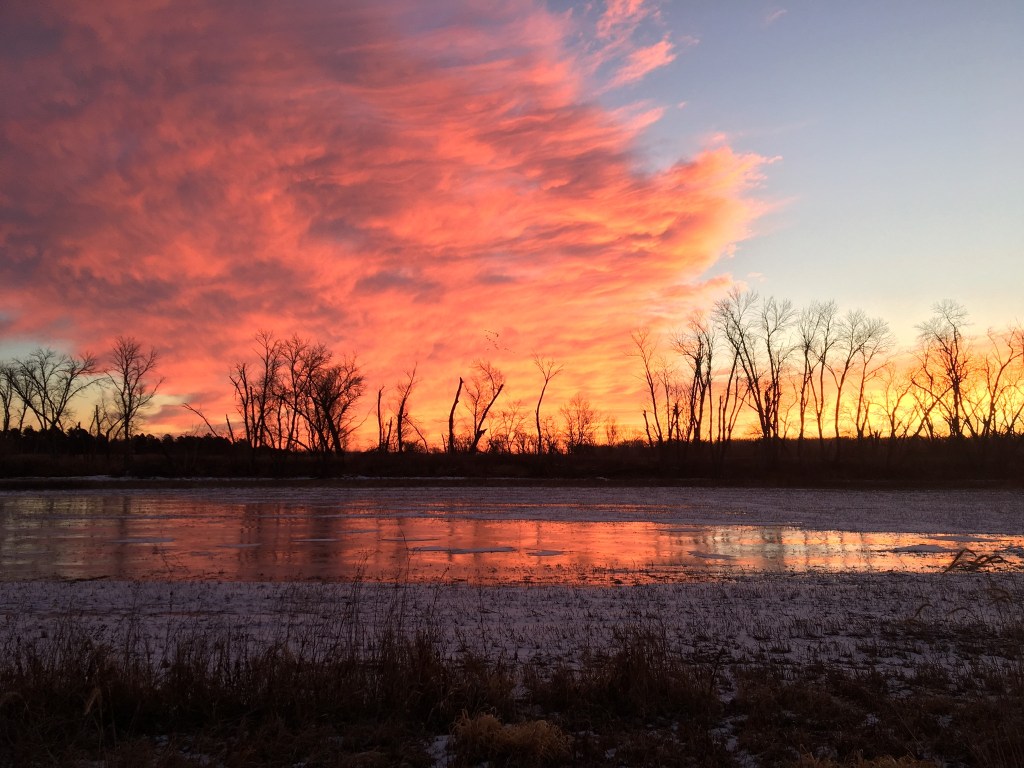
Formed by prehistoric flooding of the Missouri River, DeSoto National Wildlife Refuge has served as the site spectacular flights of geese and ducks since the last ice age due to its location along the traditional flyway.
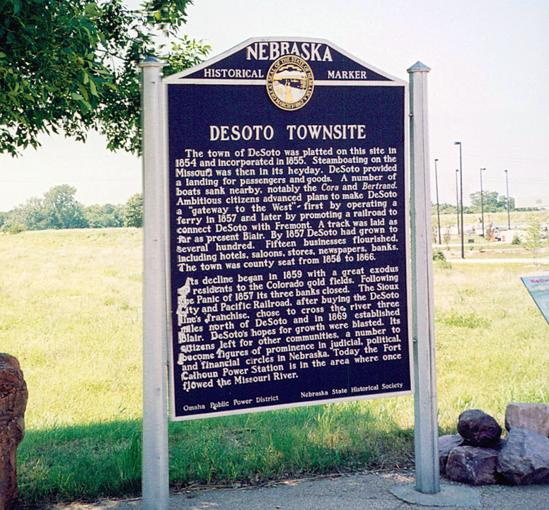
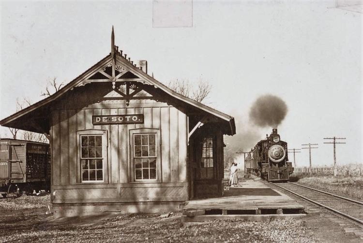
It is located near the DeSoto River Bend which is named after Spanish explorer Hernando de Soto. The town of the same name once served as a key transportation destination along the river in the mid-19th century.
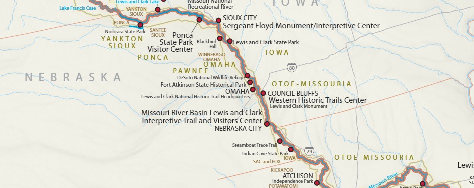
One of the first documented expeditions into this part of the river valley occurred when Lewis and Clark traveled through the area seeking a land route to the Pacific Ocean. A journal entry dated August 3, 1804 described a meeting with Native Americans at the “council-bluff”. The party set out in the afternoon and camped five miles upstream. While the river channel has changed many times since then, the Lewis and Clark campsite was probably located at the river loop which is now called DeSoto Bend. They noted an abundance of wildlife in the area.
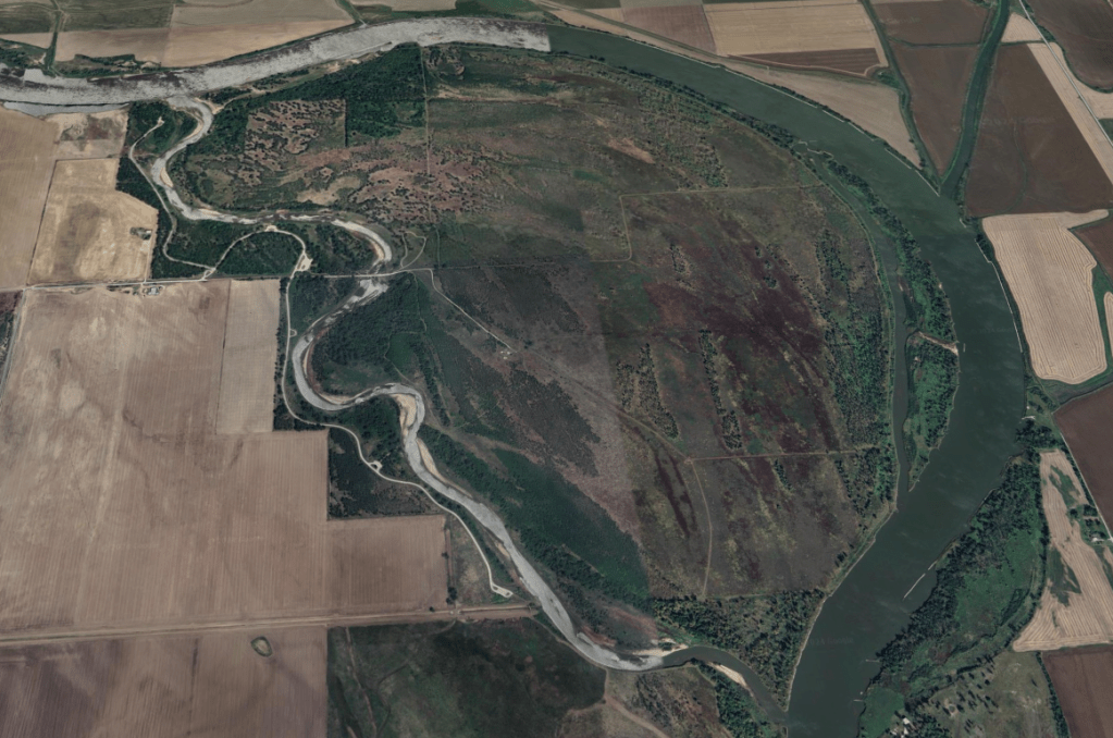
The seven mile long lake that is the heart of DeSoto Refuge was once a hazardous bend in the Missouri River. Despite that, by the mid-1800 the Missouri River was a major artery for trade. Steamboats carried supplies to fur trading posts, frontier settlements and mining towns. During the 19th and 20th century, more than 800 steamboats sank or were stranded between St. Louis and Fort Benton, Montana.
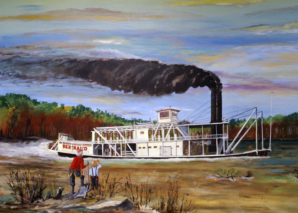
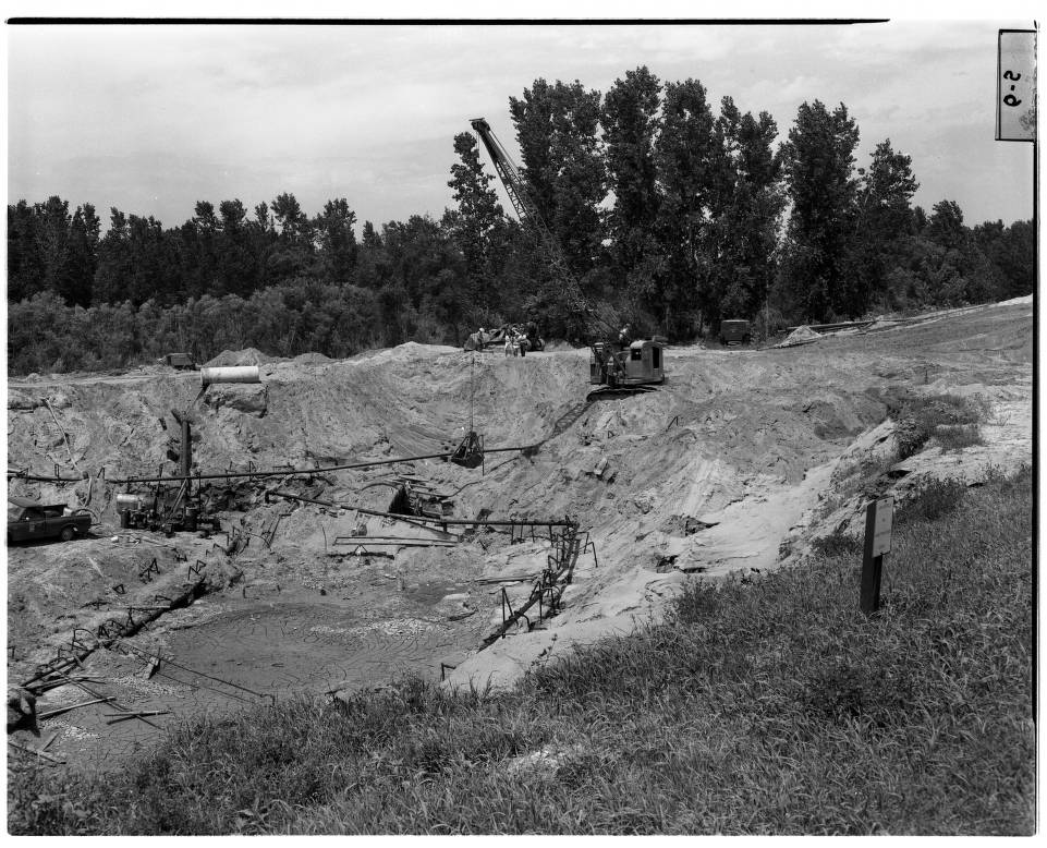
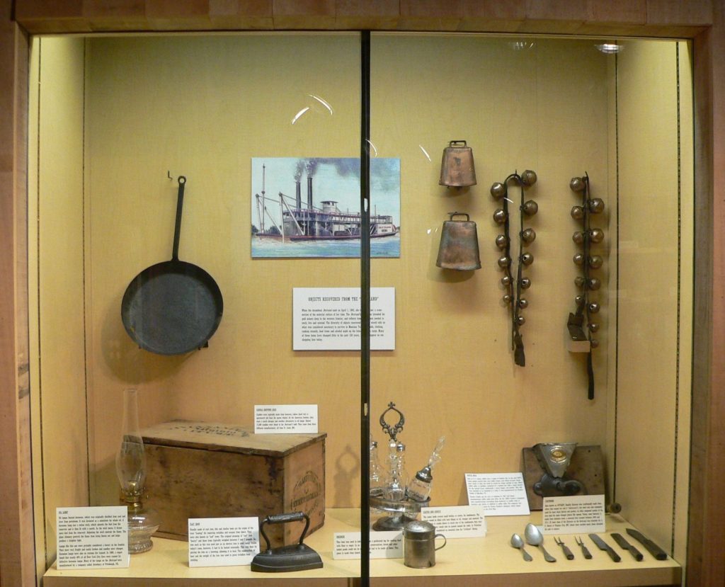
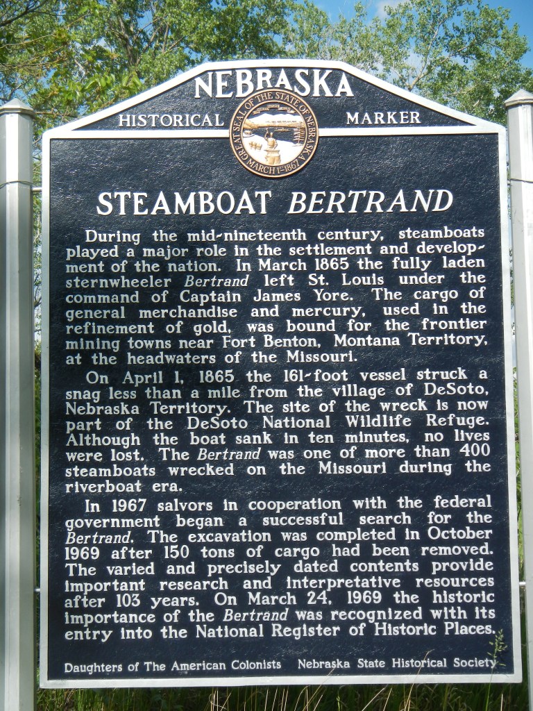
While en route to the Montana Territory in 1865, the Bertrand steamboat sank in the Missouri River after hitting a submerged log. It was quickly covered in mud creating a time capsule of Civil War-era material. The boat and its cargo was rediscovered in 1968. Over 500,000 items were excavated from the wreck site which was uncovered from underneath 30 feet of mud. They found a number of items needed for the new territory’s gold mines, logging camps, farms and households. In addition to tools and equipment, food and clothing were discovered. Many of the items were in excellent condition. Apparently insurance company divers removed most of the mercury and other valuables soon after the ship sank. The Bertrand is listed on the National Register of Historic Places. You can visit the pond where the hull of the steamboat lies buried.
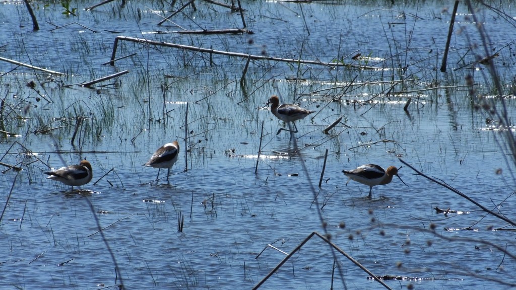
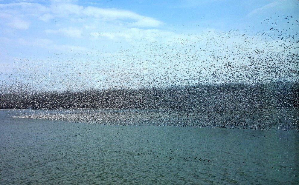
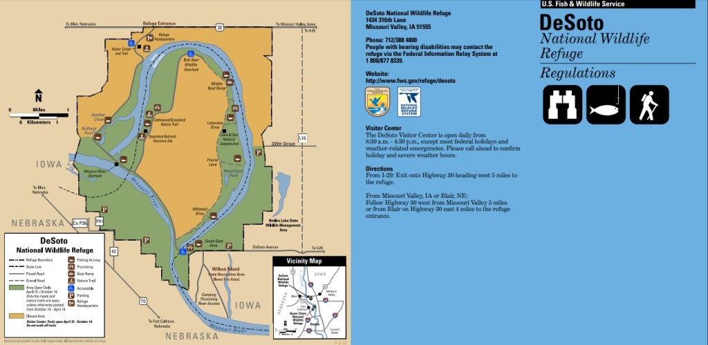
Many changes have occurred in the Missouri River Valley since settlement began in the early 1800’s. Land clearing projects, drainage projects, river channelization and flood control have transformed the river floodplain from a diverse wildlife habitat to farmland. Since 1958 when the DeSoto National Wildlife Refuge was established, it has served as a part of a network of refuges dedicated to preserving and restoring increasingly scarce habitat for migratory waterfowl as well as other wildlife. Its primary purpose is to serve as a stop over for ducks and geese that migrate each season. 550,000 snow geese utilize the refuge as a feeding and rest area during their fall migration between the Arctic nesting grounds and the Gulf Coast wintering areas. 50,000 ducks, most of which are mallards, are common in the refuge during the fall migration. October and November are the months of peak use with smaller numbers returning in March and April. Bald eagles follow geese into the area with many spending winter here until March. Other animals in the area include white-tailed deer, cottontails, raccoons, coyotes, opossums and fox squirrels. The backwater areas and wetlands provide habitat for beaver, muskrat and mink. Woods, prairie grass and hedges attract songbirds as well as turkeys, pheasants and quail.
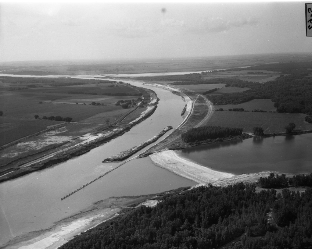
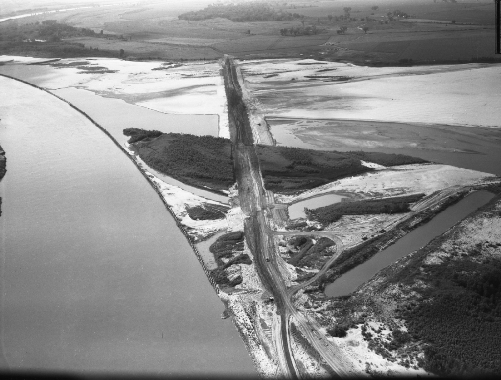
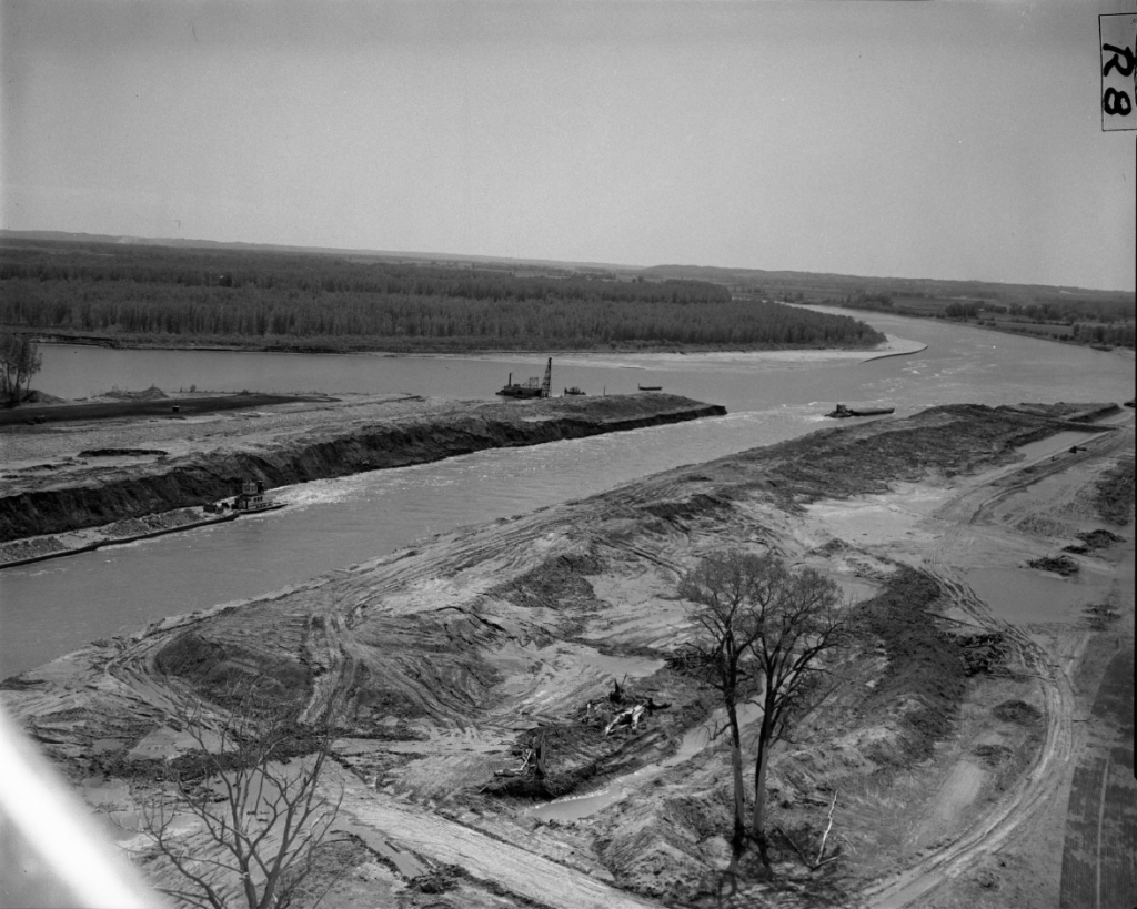
The federal government made a shorter route through the bend in 1959 in order to improve navigation. In 1960 the US Army Corp of Engineers completed the DeSoto Bend Cut-off project, forming the current DeSoto Lake and straightening out the Missouri River to its current path. Since 1965 more than 1,500 acres of land have been reverted to grasslands. The wildlife managers use fire as a management tool to maintain healthy stands of native grasses. In total the refuge spans 8,365 acres of land. The site has a number of trails in addition to fishing, boating, hunting and mushroom picking.
The Boyer Chute National Wildlife Refuge was named after the Boyer Chute that crosses through the middle of the refuge. Boyer Chute is also managed by the staff of DeSoto. Located one mile south on the Missouri River near Fort Calhoun. The channel was restored after being blocked in 1937 to aid riverboat navigation. Following its restoration, many of the wildlife species that historically utilized the land returned. Visitors can hike and watch for bids along nine miles of trails.
Today the 8,000+ acre DeSoto Wildlife Refuge is extremely popular for viewing migrating waterfowl and other birds including bald eagles. It offers a variety of hiking trails, biking, boating, kayaking, canoeing, fishing and hunting in permitted areas. Its also the home to one of the nation’s premir Civil War era museum collections including the cargo of the sunken steamboat.
Please feel free to comment to share your thoughts and memories.
Until next time, keep exploring!
Bonus pics
Subscribe
Type your email address below to be notified when a new story is posted.
Follow me on
Sponsor
Please contact me if you’re interested in sponsoring Omaha Exploration page: https://omahaexploration.com/contact-me/

Leave a comment