
After Council Bluffs was named the eastern terminus of the transcontinental railroad in 1863, construction started in Omaha which established itself as an important transportation hub. As a result a wholesaling jobbing district began to form in 1880. Jobbers purchased commodities directly from manufacturers and sold them to retailers. These businesses ultimately propelled Omaha’s economic growth.
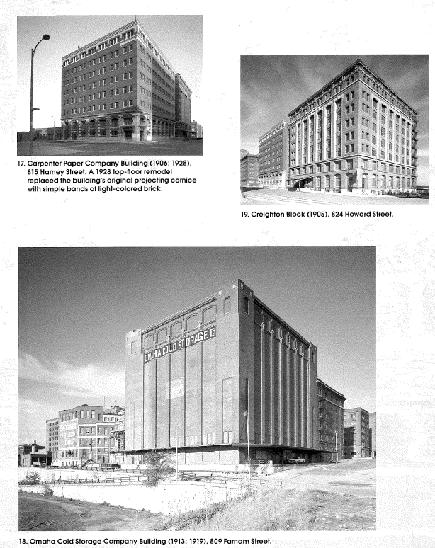
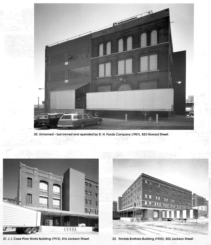
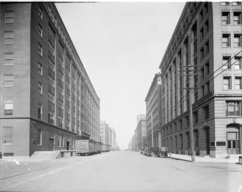
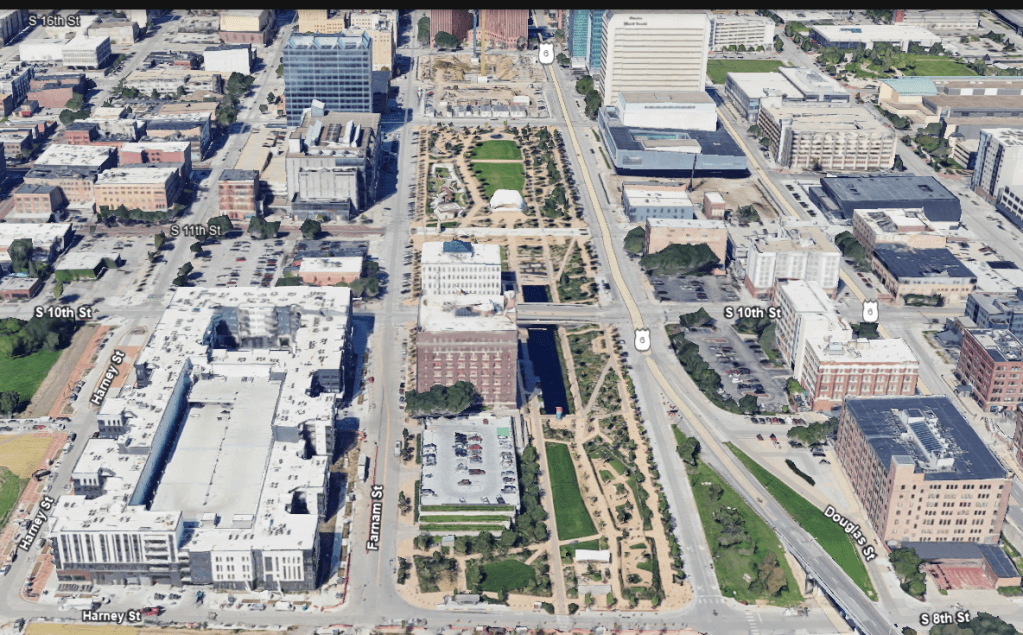
From 1888 until 1920 some of Omaha’s largest wholesale companies built impressive warehouses along the Missouri River at a place of higher elevation that was less prone to flooding. Flooding was one of the reasons that a large industrial center in East Omaha failed to fully develop. The warehouses stretched from 8th to 10th Streets and from Farnam to Jackson Streets. The massive structures created an urban “canyon” effect on a three block stretch along 9th Street thereby earning the nickname Jobbers Canyon.
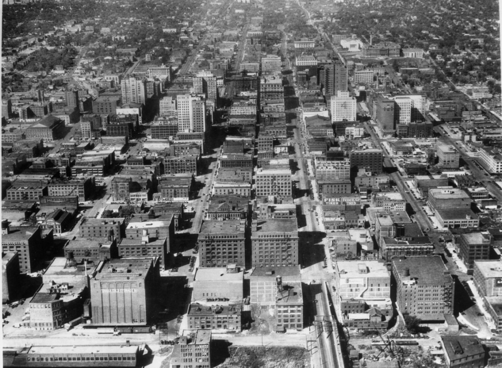
Downtown Omaha continued to thrive as a center of commerce well into the 20th century but began to suffer as the city expanded west. Among the factors that led to the decline of the urban core were the construction of suburban business parks, shopping centers and neighborhoods.
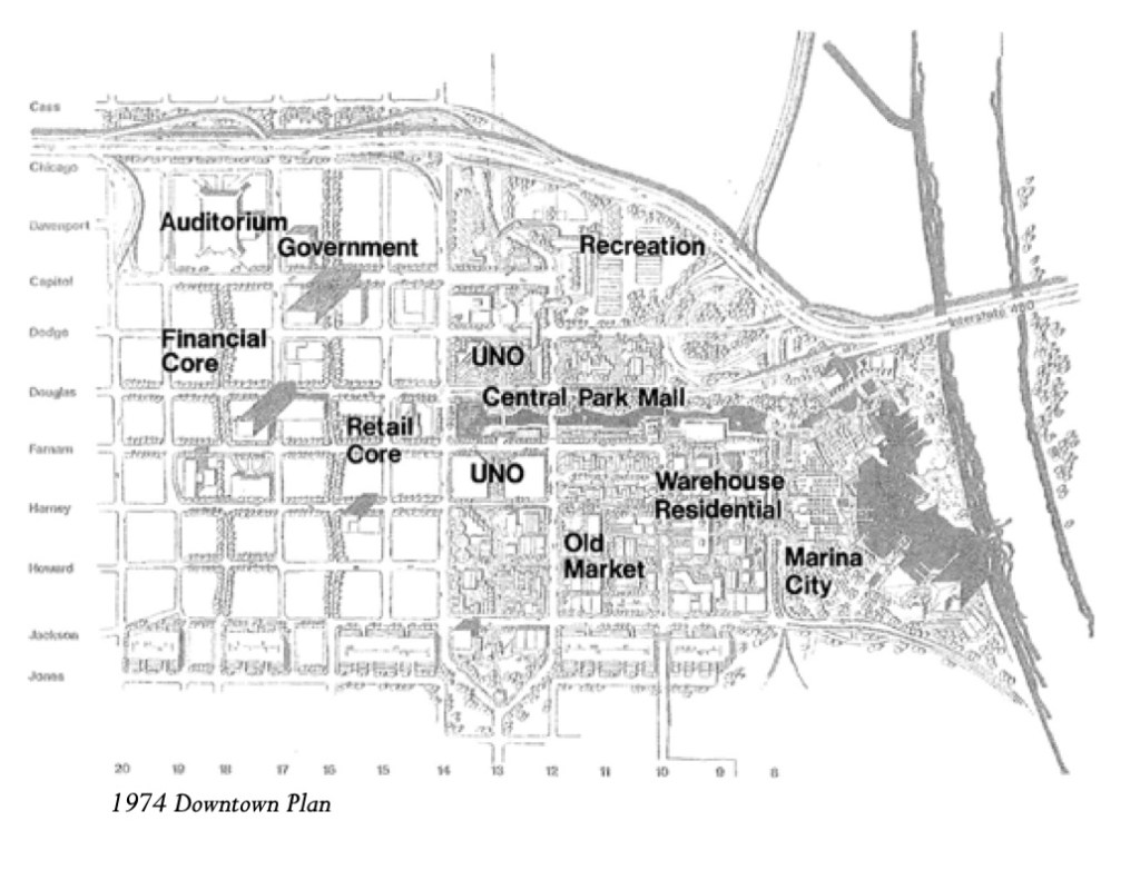
By the time the 1980s arrived, the downtown district lost its place as the regional retail and office center of the city. City leaders realized it and began a decades-long effort to revitalize downtown Omaha while drawing more people back to the area. The goal was to make downtown a more desirable place to live, work and play. This led to the construction of Central Park Mall which was designed to connect the business district to the river from which the city began. The plan also included the development of an area called Marina City.
City planners at the time stressed the potential of the riverfront and the old warehouses in the area. They even acknowledged that many of the buildings were in good structural condition and could be easily renovated. Having already witnesses the success of the Old Market thanks to visionaries like Sam Mercer, there was a proposal to reclaim and reuse the buildings for housing.
By 1986 there was a push to designate Jobbers Canyon as a district on the National Register of Historic Places. Meanwhile, Congra had grown into one of the largest food companies in the country. Founded in 1919 in Grand Island and relocating its headquarters to Omaha in 1922, the company had outgrown its headquarters and began the search for a new home.
Omaha had just lost thousands of jobs when Houston Natural Gas fled to Texas. The city was fearful that Conagra would do the same thing exacerbating the decline of downtown Omaha. While a number of locations were considered, its CEO preferred a suburban style campus to a skyscaper. The company threatened to leave unless the state passed legislation that provided tax credits to company’s that made capital investments and created jobs. Nebraska did just that and the company decided to stay. The only question was where.
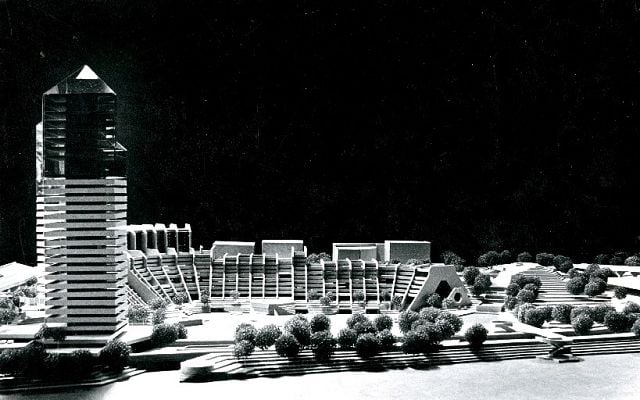
The city steered Conagra towards the riverfront and developed a plan that called for a corporate campus comprised of a high-rise tower and several low-rise structures along the river. It also preserved all of the warehouses except for Duncan Hines and Omaha Cold Storage. This solution had the added benefit of connecting Central Park Mall which ended at 8 Street to the Missouri River.

While it seemed all stakeholders were onboard, Conagra’s CEO surprisingly rejected the plan. He went on to say that Conagra would not build its shiny new corporate campus next to “some big, ugly red brick buildings”. He thought the large buildings would dominate the riverfront and compress the campus too much.
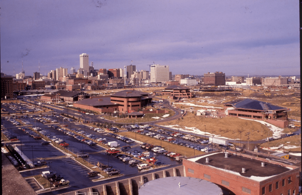
Rather than lose Conagra to another part of the city, it agreed and the buildings were demolished just six months after being added to the National Register of Historic Places in 1989. Once the plan was announced, preservationists stepped in and attempted to rally support to save the buildings and it even received national attention.
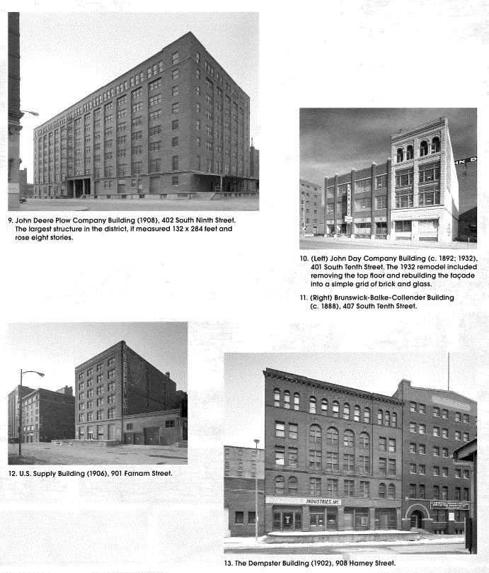
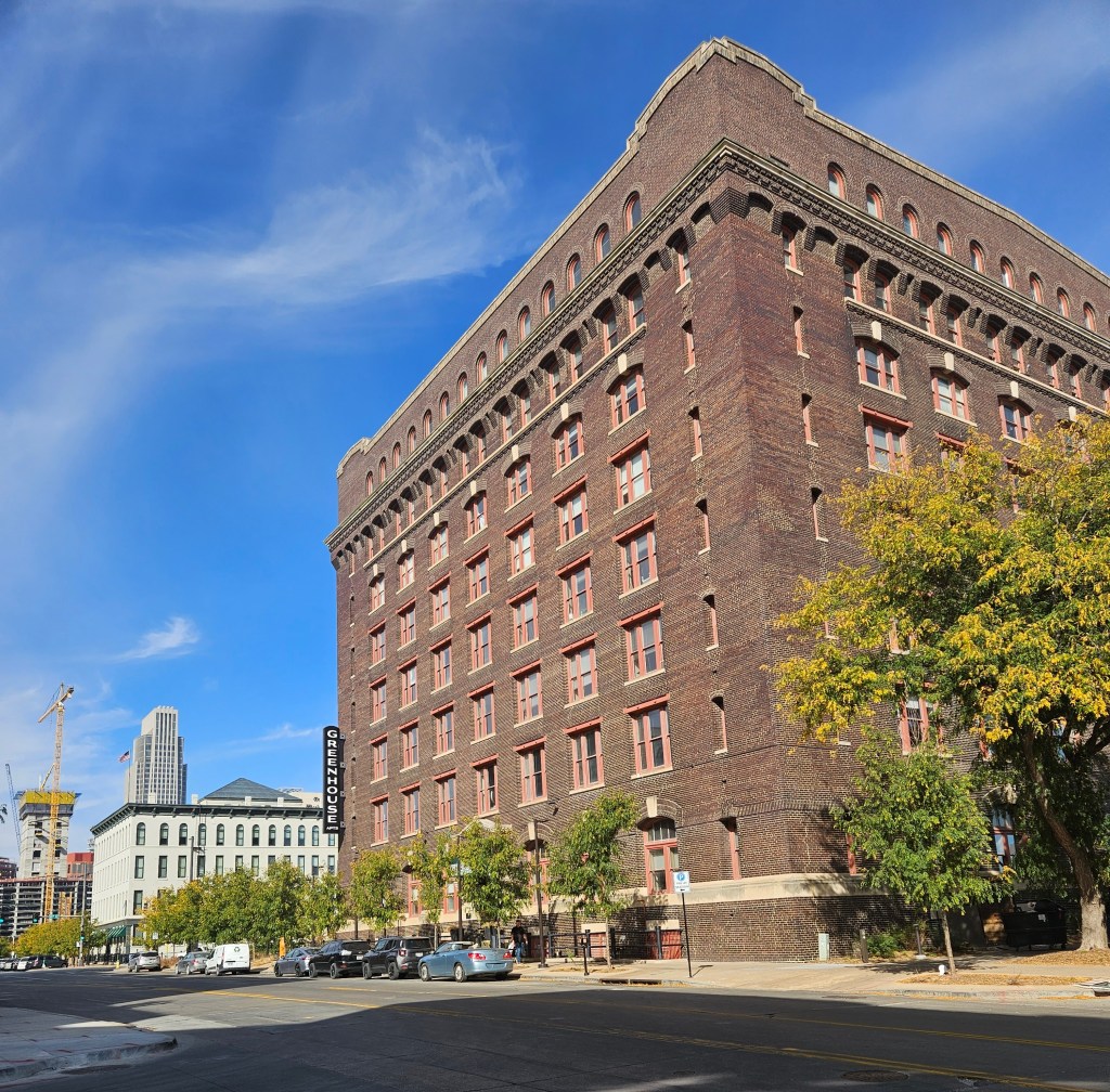
A single building was saved, the Nash Block at 902 Farnam Street which was in the process of an $11-12M rehabilitation project that would convert it into residential apartments that became known as The Greenhouse.
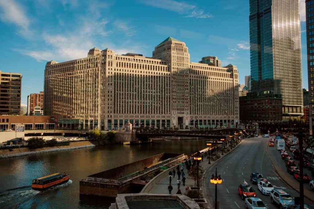
Nearly 100 years since its founding, it relocated its headquarters from Omaha to a historic district in downtown Chicago called the Merchandise Mart in 2016. The move resulted in the loss of 1,500 jobs while 1,200 jobs remained in Omaha. It also resulted in the loss of one of Omaha’s five Fortune 500 companies.
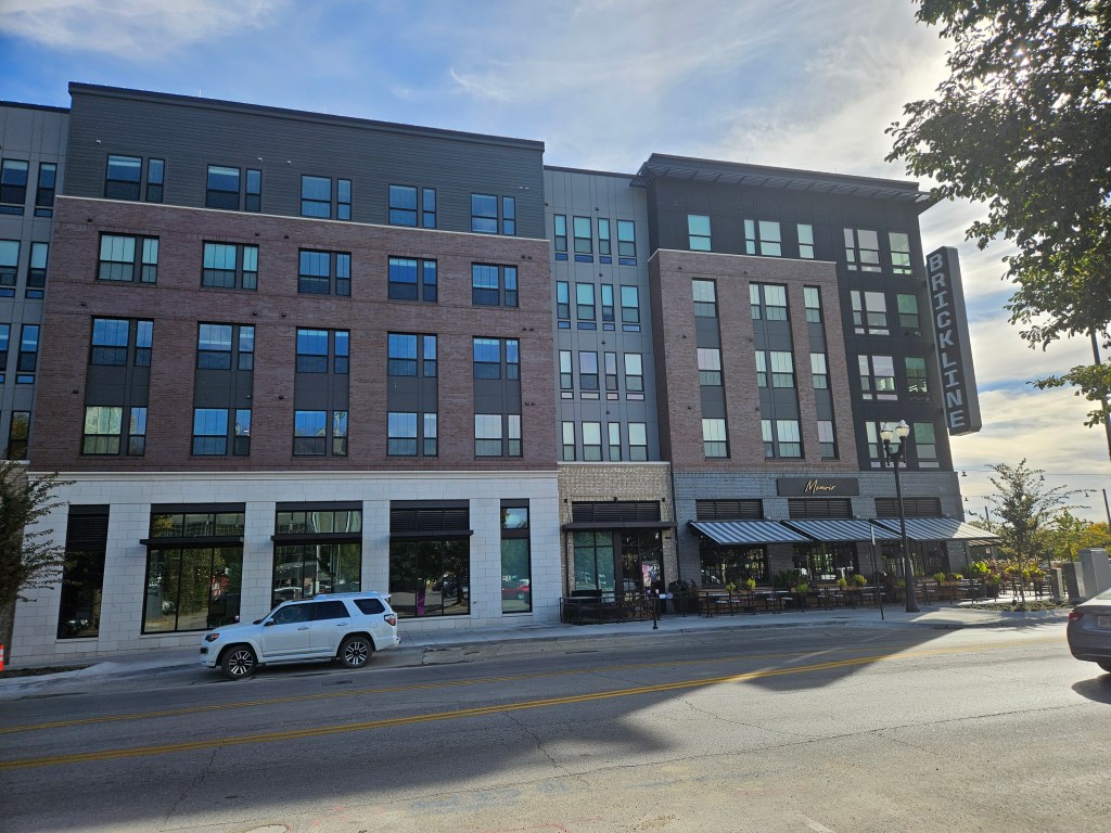
In 2022 a portion of the Conagra campus was demolished to make way for the Brickline at the Mercantile building which includes 389-apartment and a 640-stall parking garage. The above market rate apartment complex includes ground level space for three restaurants. Amenities include an entertainment terrace, club room, co-working lounge, fitness center, media and game lounge, golf simulators, pet spa and bike storage.
Please feel free to comment to share your thoughts and memories.
Until next time, keep exploring!
More pictures
Omaha Exploration is sponsored by

Click here to contact me if you’re interested in sponsoring OE.
Get email notifications when new OE content is posted
Follow OE on the socials
Omaha Exploration, 2024. Unauthorized use and/or duplication of this material without express and written permission from this site’s author and/or owner is strictly prohibited. Excerpts and links can be used, if full and clear credit is given to Omaha Exploration with appropriate and specific direction to the original content.

Leave a comment